How have drones impacted building surveying?
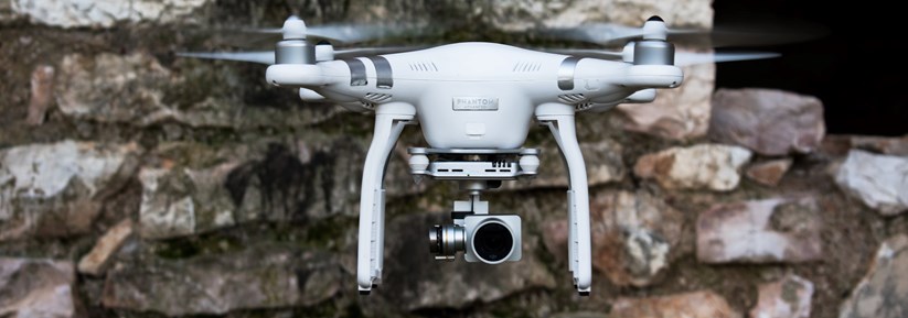
Drones, also known as unmanned aerial vehicles (UAVs), have become increasingly popular in surveying, particularly in the evaluation and inspection of buildings. With their ability to capture high-resolution, high-quality images and data, drones have revolutionised how we approach building surveying, making the process quicker, more accurate and cost-effective.
Advantages of using drones
One of the most significant benefits of using drones for building surveying is the speed at which high-level survey data can be captured. Traditional surveying methods can take hours or even days to complete, depending on the size of the building or area, often with the use of scaffolding or other high-level access equipment. However, drones equipped with cameras and mapping tools can survey large structures in a fraction of that time while producing high-quality data with incredible precision.
Using drones also enables surveyors to capture data in inaccessible areas. For example, using a drone to inspect the roof of a large or a derelict building can be done quickly and safely, eliminating the need for manual inspections that can be both dangerous and time-consuming.
High-level data capture for areas such as roofs, stacks, gutters, flashings, etc., significantly reduces the need for further investigations and limitations in survey reports.
By using drones to capture multiple, high-resolution images of a building from different angles and using specialised software, surveyors can generate 3D models of a building, which can provide a comprehensive picture of its structure, including identifying structural defects and anomalies.
Drones can also be used to detect and identify heat loss and water damage. The high-quality images captured by drones can reveal temperature and moisture differences in a building, which can lead to identifying potential issues such as leaks, inefficient insulation or other structural problems.
Traditional surveying methods that involve the use of large and complex equipment can be costly and often require multiple contractors to complete the job. Drones, on the other hand, are relatively inexpensive to operate and require only a single operator to conduct the inspection.
Property inspections
One of the most significant applications of drone surveying is in the inspection of properties. By using drones, inspectors can gather images and data that can be used to assess a property’s condition including identifying damage to roofs, walls and exteriors. This technology can also collect data on electrical installations, plumbing systems and HVAC systems. Drones can gather more data in a shorter time than manual inspections and can pinpoint issues that need to be addressed, improving the overall accuracy of inspections.
Agency marketing
By utilising drone technology, selling agents can capture stunning high-definition aerial images and videos of the property, highlighting its size, outdoor features, grounds and surrounding views. Having access to high-quality, panoramic footage can create a competitive edge in the agency market, attracting more potential buyers and, in turn, increasing chances of a successful sale.
Property management
For property managers, drones can help monitor, inspect and maintain their properties. With the help of visual and thermal imaging, drones can identify problems, detect maintenance issues and reduce the risks of serious faults that can often go unnoticed. Using drones for aerial inspections is also safer and quicker than traditional methods, which saves time, reduces costs and increases productivity.
Flood damage and insurance
Drones are increasingly being used in the flood damage assessment and insurance market due to their ability to capture high-quality aerial images. These images can be used to assess the extent of damage caused by floods, which is particularly helpful in areas that are difficult to access. Drones equipped with thermal imaging cameras can also be used to detect areas that are still hidden by floodwaters. Insurance companies, adjusters and surveyors can then use this information to accurately assess flood damage, determine repair and restoration costs, and ultimately process claims more efficiently.
Construction and development monitoring
Drones are also frequently used in the construction industry for the purpose of monitoring and inspecting construction sites. There are many ways that drones can be used on construction sites:
- Site mapping: Drones can create detailed site maps, which can be used for planning and design purposes. They can capture accurate topographical data of the site, creating 2D and 3D maps.
- Progress monitoring: With high-resolution cameras, aerial images from drones allow construction managers to compare current site conditions to the original site plan and track the progress of a project.
- Safety inspections: By flying over the site, drones can detect potential hazards like loose scaffolding, falling debris or unstable structures.
- Materials, plant and machinery tracking: Drones can be used to locate and track construction materials, plant and machinery by means of timelapse inspections, for instance, allowing contractors and developers to capture real-time evolution of the working site conditions. An inventory of construction materials on-site can then be created, ensuring timely material delivery to the site.
Conclusion
The use of drones in surveying has truly revolutionised the way surveyors approach building inspections. The speed, safety and accuracy of drone technology provides a cost-effective solution that can help identify issues before they become more challenging and expensive to address.
Often faster, safer and more precise than traditional inspection methods, drone technology can provide accurate data on buildings and land, especially when coupled with programs like Pix4D, LiDAR and thermography datasets.
In a world where speed, efficiency and flexibility of digital data capture and report delivery is becoming increasingly key, using drones in surveying can greatly benefit the process.
Speak to your RICS surveyor about how a drone aerial inspection can add value to the property inspection process. Your surveyor can explain the different data capture points, their applications and uses, together with how they can enhance your investigation and decision-making process.